
Driving Innovation with the Leica BLK360 Laser Imaging Scanner
August 2025
At Kaymac, our mission has always been to deliver safe, efficient, and innovative solutions across marine, civil, and infrastructure projects. To support this ambition, we have invested in the Leica BLK360 Laser Imaging Scanner—a cutting-edge tool that allows us to capture environments with unmatched speed and precision.
This new technology represents a significant step forward in how we survey, document, and analyse project environments, strengthening our commitment to applying the latest digital tools to deliver smarter outcomes for our clients.
Technical Capability: Compact Power, Maximum Precision
The Leica BLK360 is the world’s smallest and lightest laser scanner, but its compact size belies its power. Designed for rapid reality capture, the BLK360 delivers:
- Full-dome laser scanning with a maximum range of 45 metres, capable of capturing millions of data points in every scan.
- High-speed capture – generating a complete, full-colour 3D scan in under 20 seconds.
- Accuracy within millimetres, ensuring reliable data for design, planning, and verification.
- Integrated VIS system – Leica’s Visual Inertial System automatically registers scans in the field, reducing reliance on post-processing and significantly accelerating project workflows.
- Seamless software integration, allowing scans to be imported directly into Autodesk, Revit, and other design platforms to produce 3D models, digital twins, and engineering drawings.
Transforming Our Survey and Design Workflows
Traditionally, capturing complex structures—such as piers, quay walls, bridges, culverts, or confined underwater-adjacent spaces—required a combination of manual measurement, photographic documentation, and multiple site visits. The BLK360 changes this process entirely.
- Efficiency: We can now capture a full, detailed 3D dataset in a fraction of the time.
- Safety: Reduced time on site means less exposure to challenging environments.
- Accuracy: Dense point cloud data ensures no detail is missed, eliminating errors and rework later in the project.
- Integration: Scans can be aligned with existing geospatial data and fed into Building Information Modelling (BIM) workflows, supporting clash detection and predictive maintenance planning.
Supporting Kaymac’s Ambition with Cutting-Edge Technology
Our investment in the BLK360 directly supports Kaymac’s ambition to remain at the forefront of marine civil engineering innovation. By combining our decades of practical expertise with the latest digital surveying technology, we are:
- Enhancing project delivery through precise digital capture.
- Supporting sustainability by reducing rework, minimising site disruption, and enabling remote collaboration.
- Future-proofing our services with data-rich outputs that can inform asset management long after construction is complete.
This technology aligns perfectly with our vision to harness the latest digital tools while staying true to our family-run values of reliability, trust, and technical excellence.
Looking Ahead
The Leica BLK360 will play a key role in shaping the way we deliver projects across marine, rail, energy and nuclear, and civil infrastructure. By embracing the newest innovations, Kaymac continues to provide clients with solutions that are accurate, efficient, and future-ready.
Our ambition is clear: to combine the latest technology with proven expertise, ensuring we remain a trusted partner for the most complex engineering challenges.
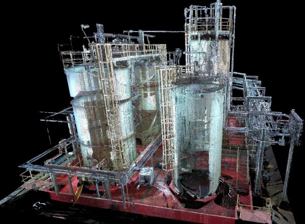
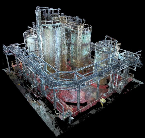
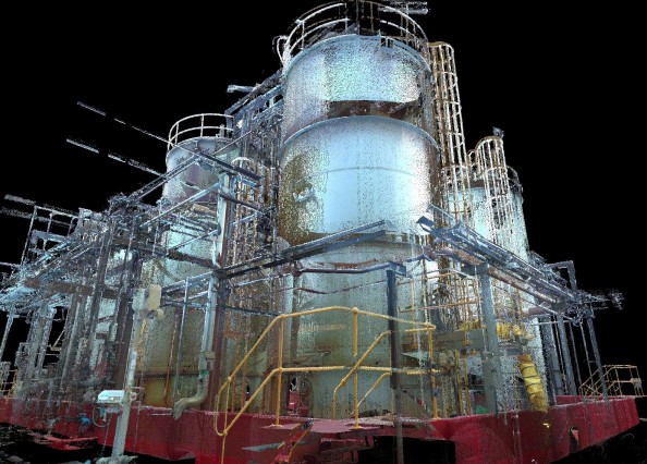
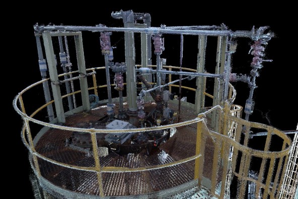
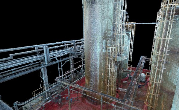
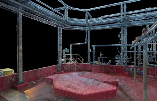
The images below don’t do the computer model justice, as it is far more detailed, but they give a good indication and example of the level of data that can be obtained accurately and quickly.